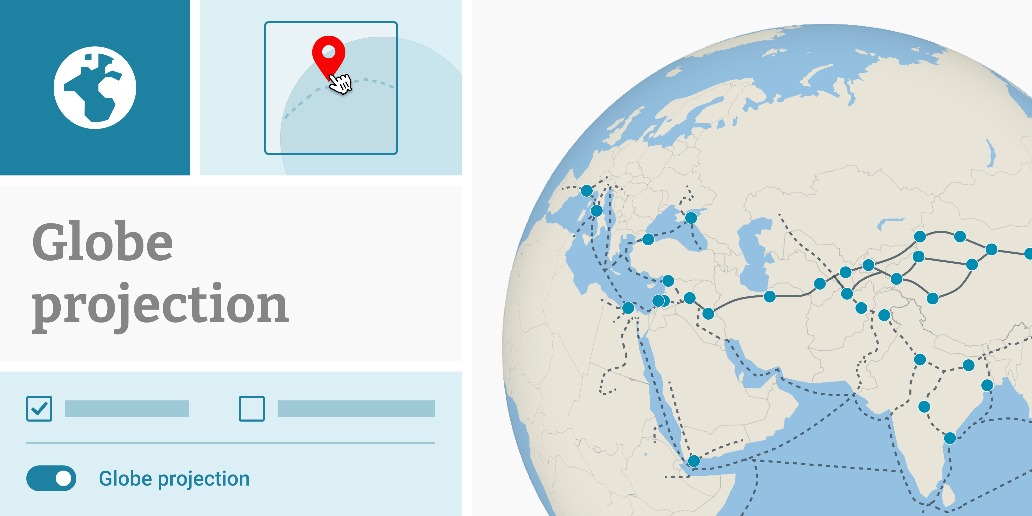
New: Globe projection in locator maps

Datawrapper’s locator maps are the perfect tool for putting your story in geographic context. From natural disasters to local landmarks, locator maps let you pick any place on earth to add your markers and tell your story.
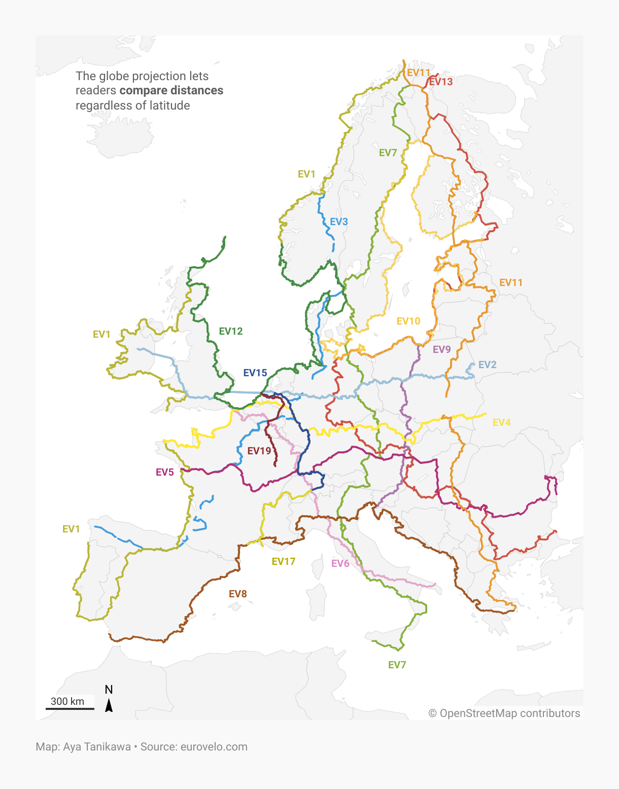
But depending on what that story is, you might find yourself needing a broader perspective. That’s why we’re introducing a globe projection that lets your locator maps go bigger than ever before.


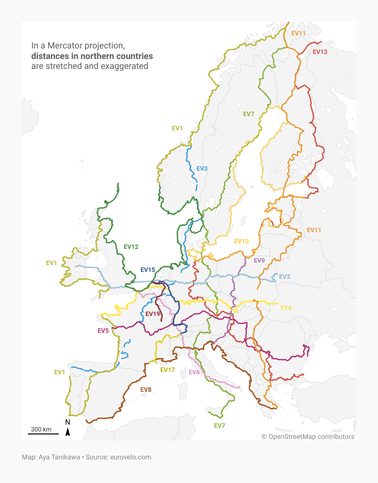
The standard Mercator projection flattens out the earth, which allows it to squeeze lots of countries into one view. But to achieve that, the shape of the countries has to be a bit distorted. In some cases — particularly near the poles — this distortion can really affect the shape of your map.


The new globe projection gives you more flexibility to create:
Maps of countries and other large regions that accurately show their relative sizes
Maps of global routes, like flights and shipping lanes
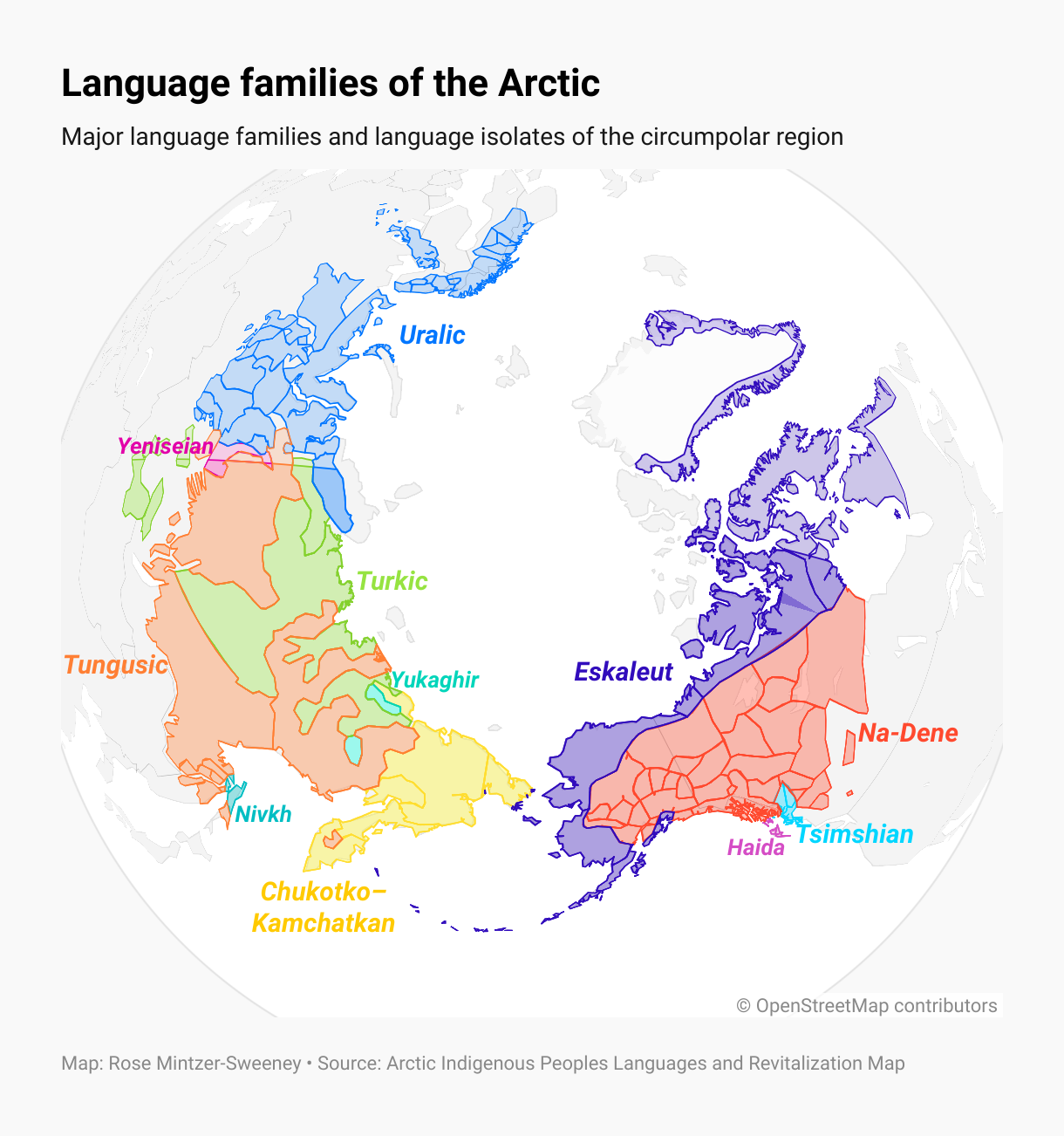
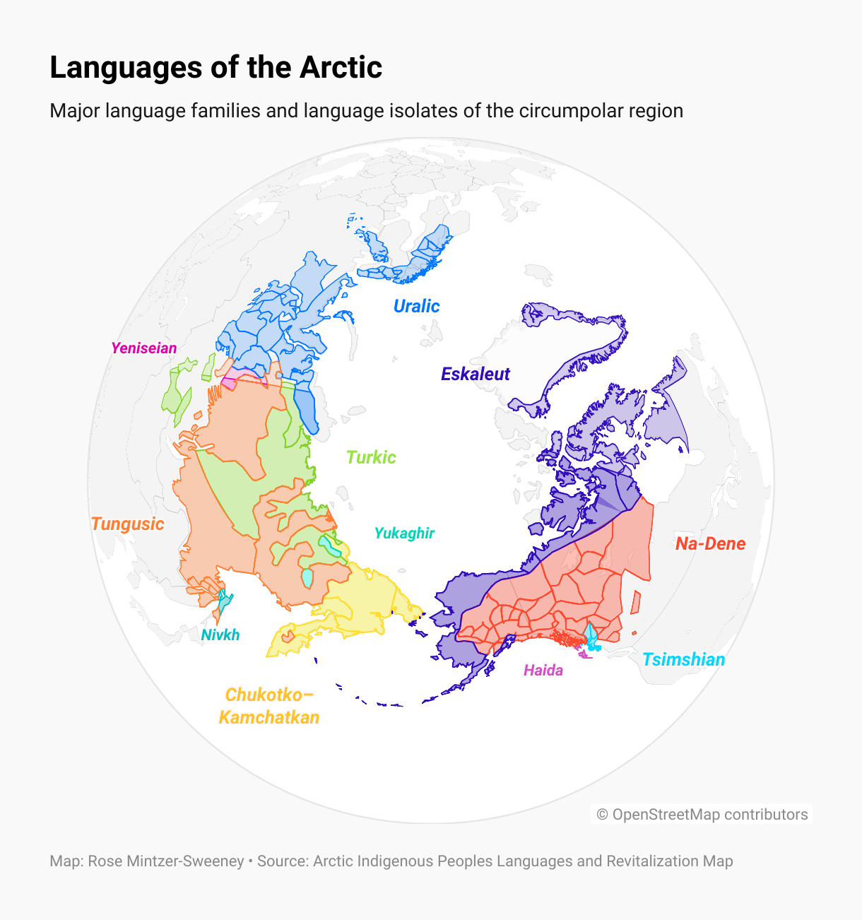
Maps of the North or South Poles
How it works
Turn on Globe projection in the Map styles section of Step 2: Design map, and to see your map displayed as a globe. Your area and point markers will wrap around the earth (of course, only half the globe can be seen at once!)
You can zoom in and Ctrl + drag to rotate the map view just as you always have. To give your globe map an offset from the center, use the Alt key and drag within the map preview.

We’ve got you covered
As with every new feature, you’ll find globe projection maps come with dark mode support and responsive mobile design. Teams on Custom or Enterprise plans can define theme settings for the horizon shadow on each map style, and use PDF or SVG export to continue editing globe maps in software like Adobe Illustrator or Figma.
Big thanks go out to Erle, Pascal, and Moritz, the developers and designers who worked on this feature. And of course to all the contributors behind MapLibre, the open source library we use to power our locator map rendering. The globe projection feature in Datawrapper would not have been possible if it wasn’t for their efforts.
We hope this feature expands your locator map horizons. Got feedback? Let us know what you think at support@datawrapper.de — and stay tuned for more updates!